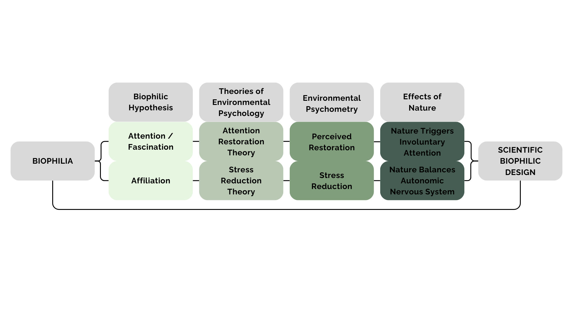
“A landscape architecture project rooted in the layered meanings of terminal, as both an airport terminal and a point of finality and succession, the ecological process by which natural systems gradually reclaim disturbed land. ”
BACKGROUND
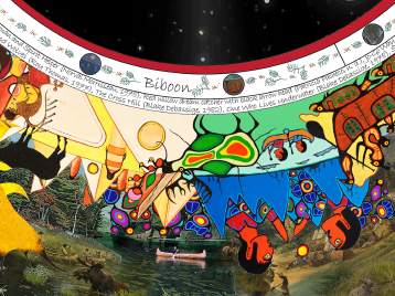
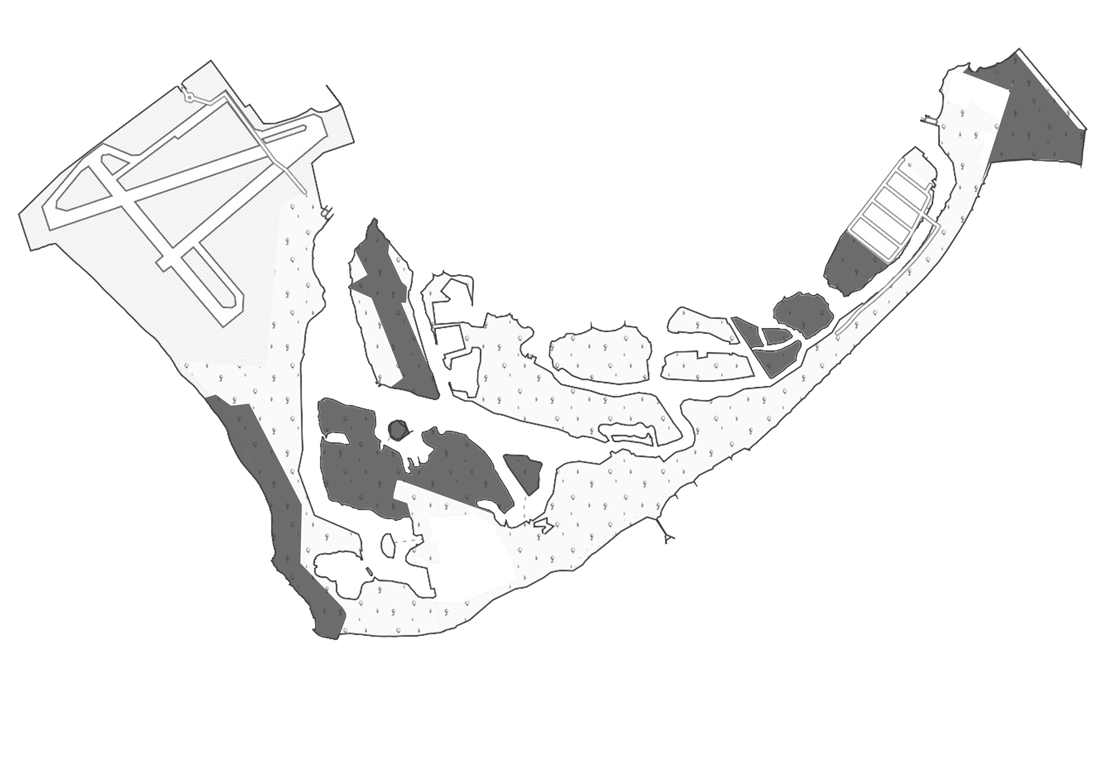
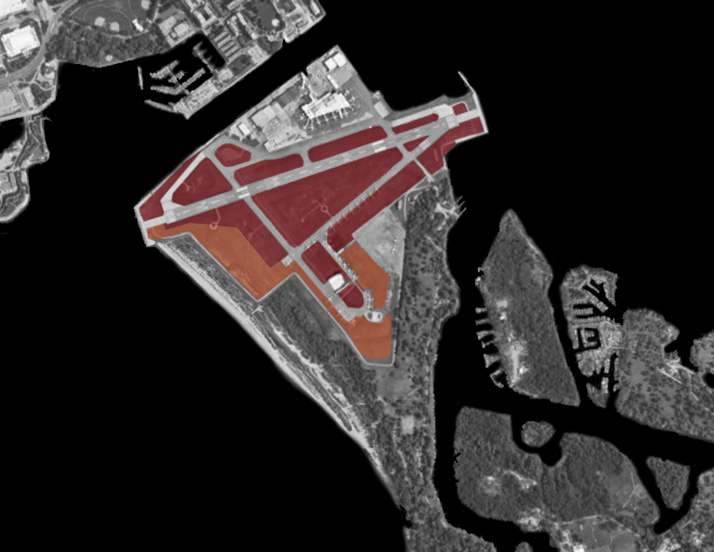
Situated on Toronto's waterfront, Billy Bishop Airport occupies a critical location with both ecological and social potential. The islands, known as Mnisiing in Anishinaabemowin, hold deep significance for the Indigenous communities of Toronto. Long before written history, these islands, along with their sandy shoals and sand spits, served as sacred spaces. They were places where Anishinaabeg mothers journeyed to give birth, where ceremonies were conducted, and where essential resources like whitefish and wild rice were harvested. Revealing and honouring the Indigenous significance of the Toronto Islands is essential for acknowledging and respecting the land’s history and the diverse Indigenous communities whose heritage is deeply intertwined with these sacred spaces. Through thoughtful and collaborative efforts, the islands can become a place where Indigenous cultures are celebrated and all visitors are reminded of the land’s legacy. However, despite their rich Indigenous history, the islands currently lack visibility and acknowledgment of this heritage. It’s crucial to rectify this oversight and ensure that all visitors recognize they are on Indigenous land. For the Michi Saagiig, the area was simply known as Mnisiing, meaning “on the islands.” Later, it became known collectively as Aiionwatha or Hiawatha’s Island. It has long been considered a meeting place and a site of healing and ceremony for Indigenous peoples. This project envisions reclaiming the site as a greenbelt, connecting Toronto’s waterfront to a network of biodiverse habitats. By reintroducing native vegetation, fostering wildlife corridors, and honouring Indigenous heritage, the design aims to restore the land’s ecological and cultural vitality.
CONCEPT
The transformation of Toronto's Billy Bishop Airport into a thriving urban ecosystem represents a bold and holistic approach to addressing the city's pressing environmental concerns while unlocking the potential for a second greenbelt on its waterfront. The urgency of combating air and noise pollution in a densely populated urban environment like Toronto cannot be overstated. By converting the airport land into a healthy ecosystem, we can strategically absorb pollutants, improve air quality, and significantly reduce noise pollution. Moreover, this design thesis lays the foundation for expanding Toronto's green infrastructure. Using ecological concepts like green corridors and edge effects to create a greenbelt along the waterfront not only enhances the city's aesthetic appeal but also fosters biodiversity, supports wildlife habitats, and promotes ecological sustainability. The design intent is to transform Toronto's Billy Bishop Airport into a rejuvenated urban landscape that reflects the island's historical significance and honours its Indigenous heritage. Through the demolition of the airport infrastructure and the intentional reformation of the land, the project seeks to emulate the island's natural past while supporting the process of ecological succession. Native plants and wildlife will be allowed to influence the landscape naturally, paying homage to the island's ecological integrity. By allowing the remaining airport structures to decay naturally, they become poignant reminders of the island's history, creating a unique setting for visitors to experience the land's natural assets. Access to the islands will be limited due to flooding and land loss, emphasizing that the project's primary focus is not humancentric but rather centred on nature, wildlife, and the passive benefits they bring. Specific features, such as an underwater tunnel, provide opportunities for people to engage with the natural environment. Additionally, repurposed structures, such as the old air traffic control tower, offer vantage points for experiencing the land, water, and sky. Overall, the design intent is to create a harmonious coexistence between humans and nature, where the land's intrinsic value is prioritized over human-centric development. The project aims to serve as a model for sustainable urban design that respects Indigenous heritage, fosters ecological resilience, and promotes the well-being of both wildlife and future generations.

A greenbelt is a protected zone of natural or undeveloped land that surrounds or weaves through urban areas, designed to limit urban sprawl while preserving ecological and recreational spaces. These landscapes often include forests, wetlands, meadows, and agricultural zones, serving as vital buffers that improve air and water quality, support biodiversity, and offer a natural escape for city dwellers. In ecological terms, greenbelts are especially valuable because they enhance the edge effect; the increased biodiversity that occurs where different ecosystems meet, such as forest edges or wetland boundaries. These transitional zones provide diverse habitats that attract a wide range of plant and animal species. By integrating greenbelts into urban design, cities can create more resilient, sustainable environments that foster both ecological health and human well-being.
PROCESS
A greenbelt is a protected zone of natural or undeveloped land that surrounds or weaves through urban areas, designed to limit urban sprawl while preserving ecological and recreational spaces. These landscapes often include forests, wetlands, meadows, and agricultural zones, serving as vital buffers that improve air and water quality, support biodiversity, and offer a natural escape for city dwellers. In ecological terms, greenbelts are especially valuable because they enhance the edge effect, the increased biodiversity that occurs where different ecosystems meet, such as forest edges or wetland boundaries. These transitional zones provide diverse habitats that attract a wide range of plant and animal species. By integrating greenbelts into urban design, cities can create more resilient, sustainable environments that foster both ecological health and human well-being.

<1800

1818

1889

1904

1913

1935

1962

2025
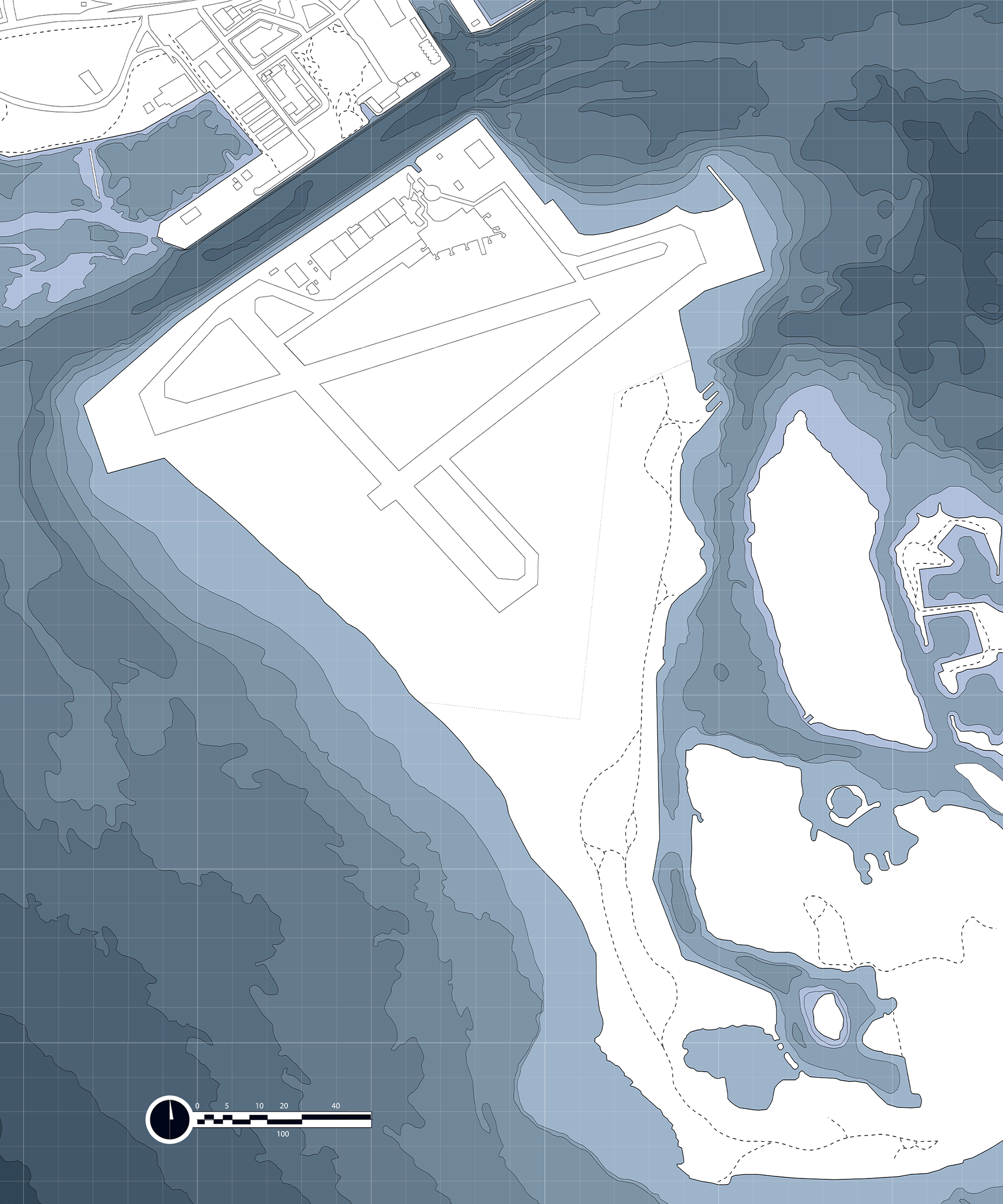
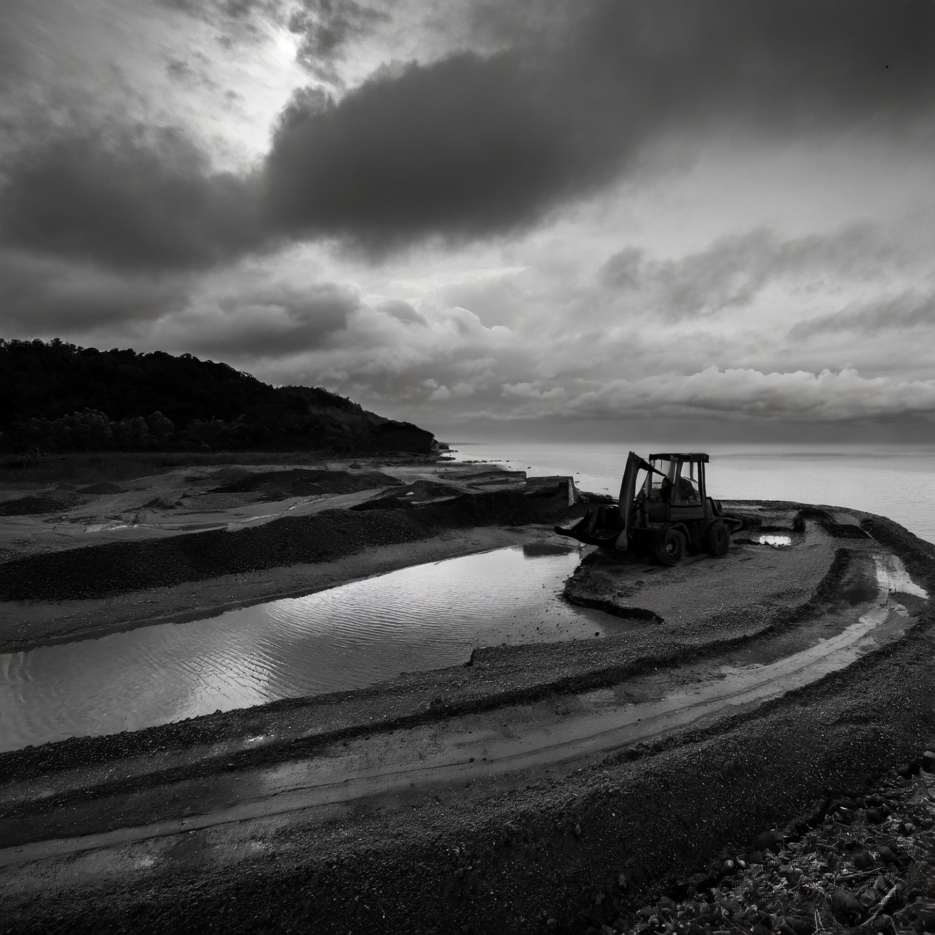
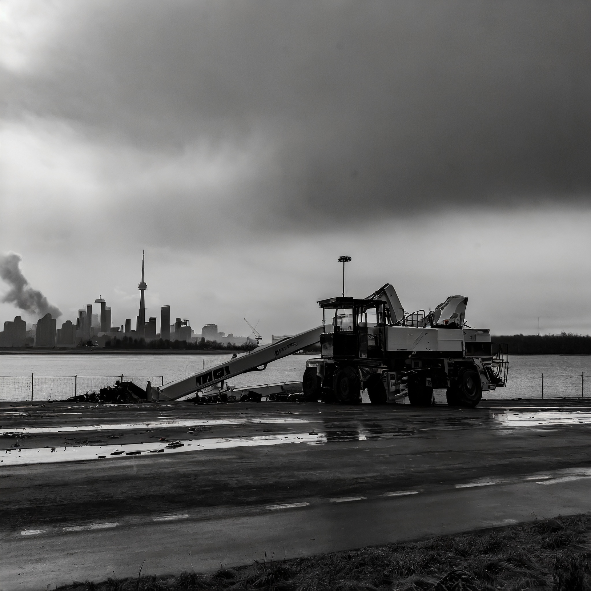
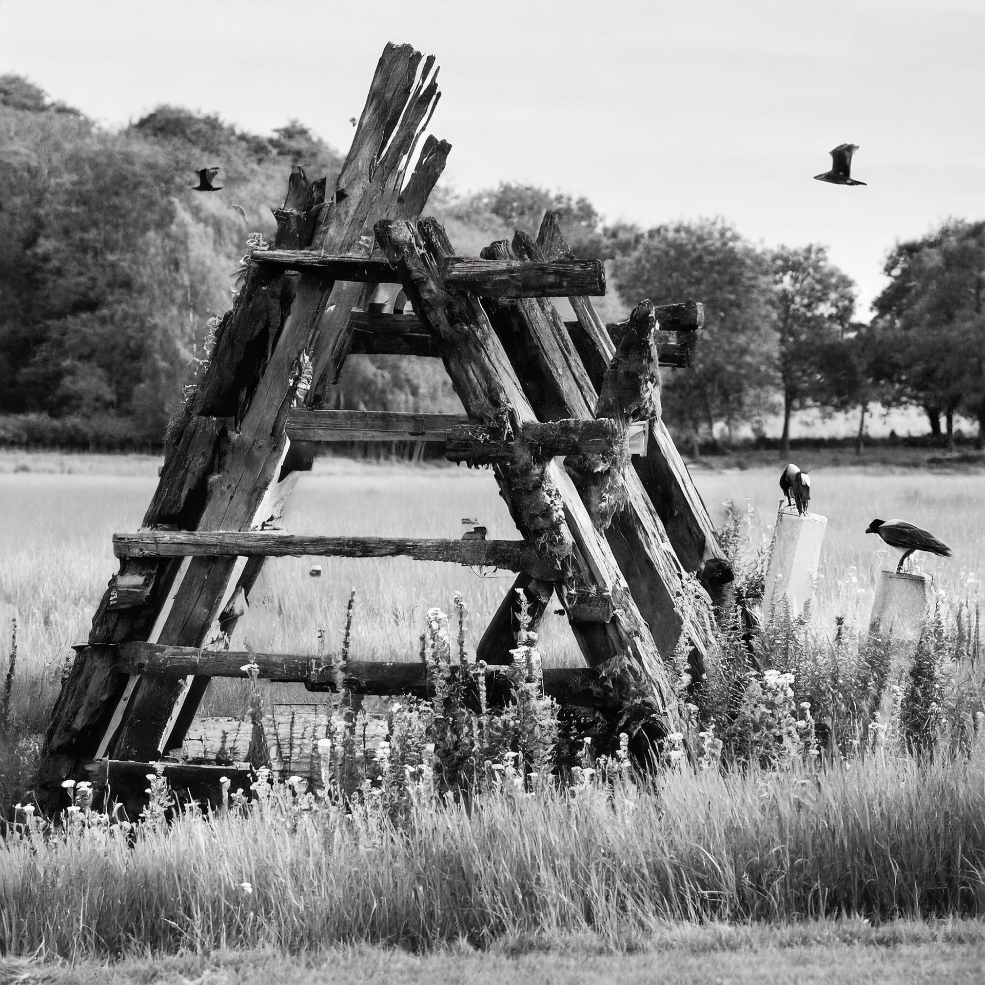
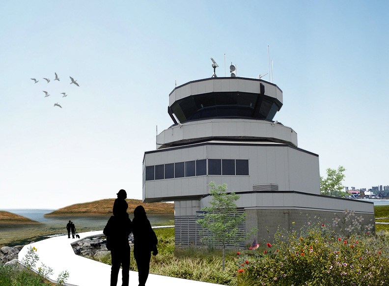
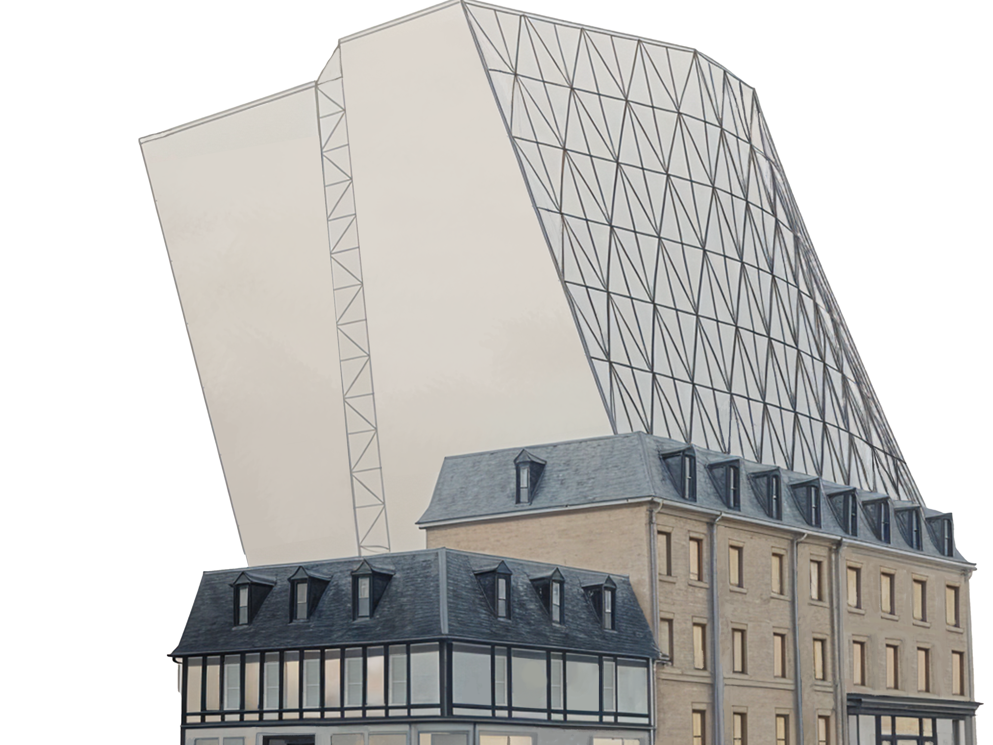
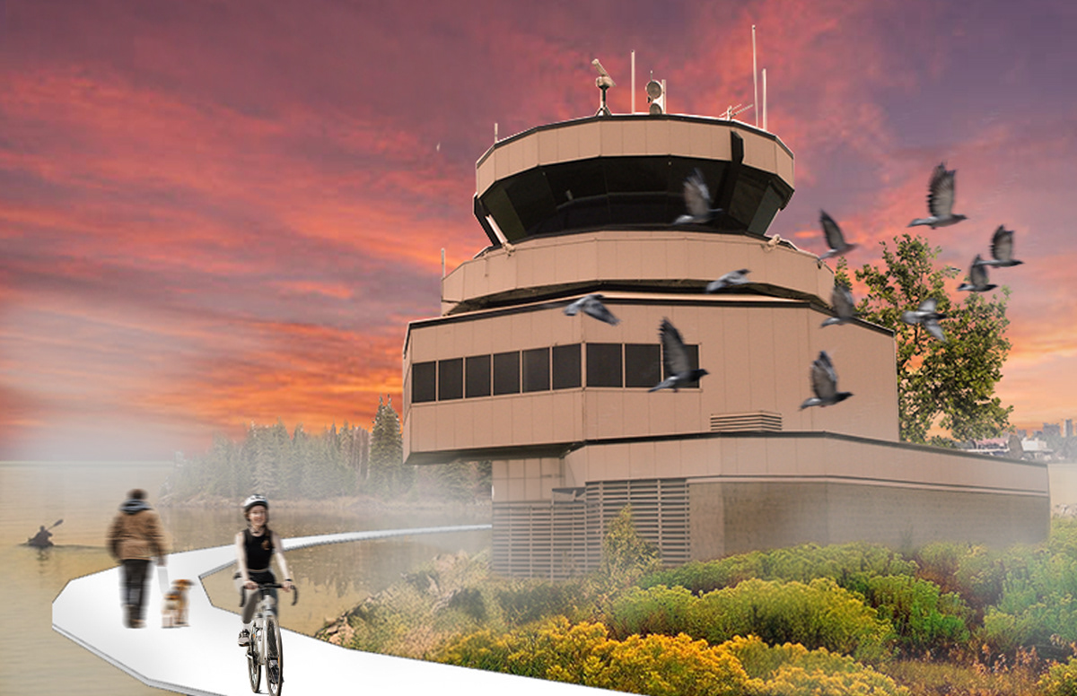
Stage 0 – Existing Condition The project begins with the airport in its decommissioned but intact state. Runways, terminals, and supporting infrastructure remain untouched, representing a landscape suspended between function and abandonment ready for transformation. The air traffic control tower undergoes minimal intervention to become a future outlook pavilion.

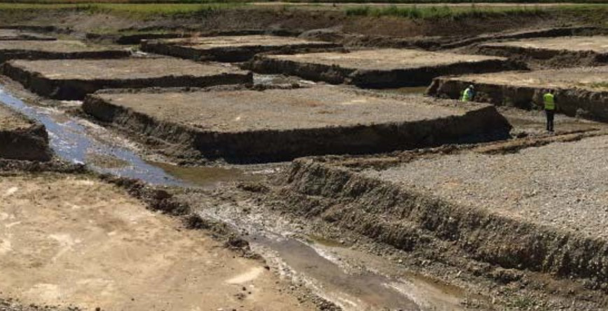
Stage 1 – Construction & Preparation Renaturation begins with the scoring of runways to encourage water ingress and initiate erosion. Select structures, such as hangars, are dismantled and reduced to their skeletal frameworks, designed to decay naturally. The air traffic control tower undergoes minimal intervention to become a future outlook pavilion. Native plant species are introduced to initiate ecological succession and support early biodiversity.
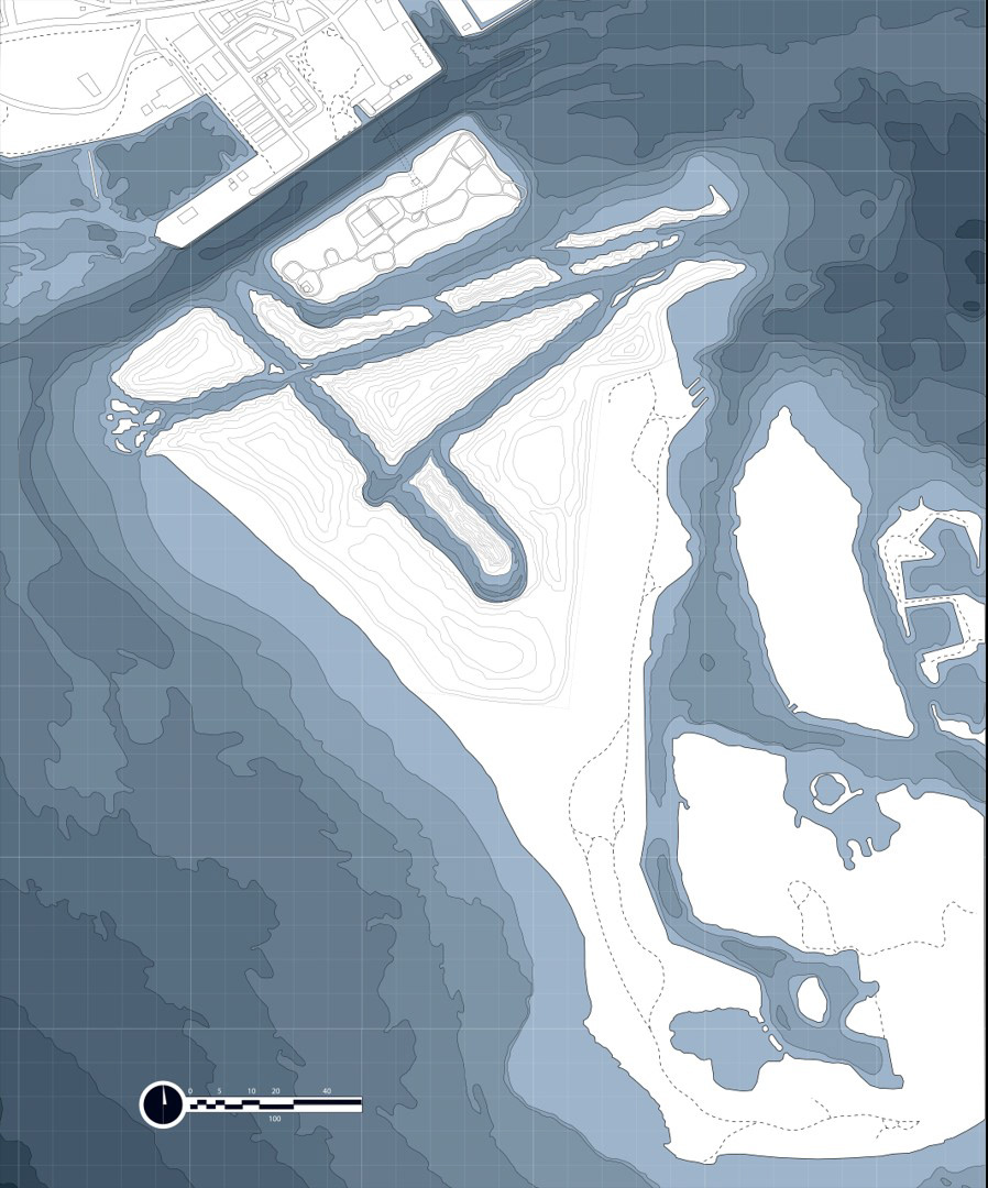
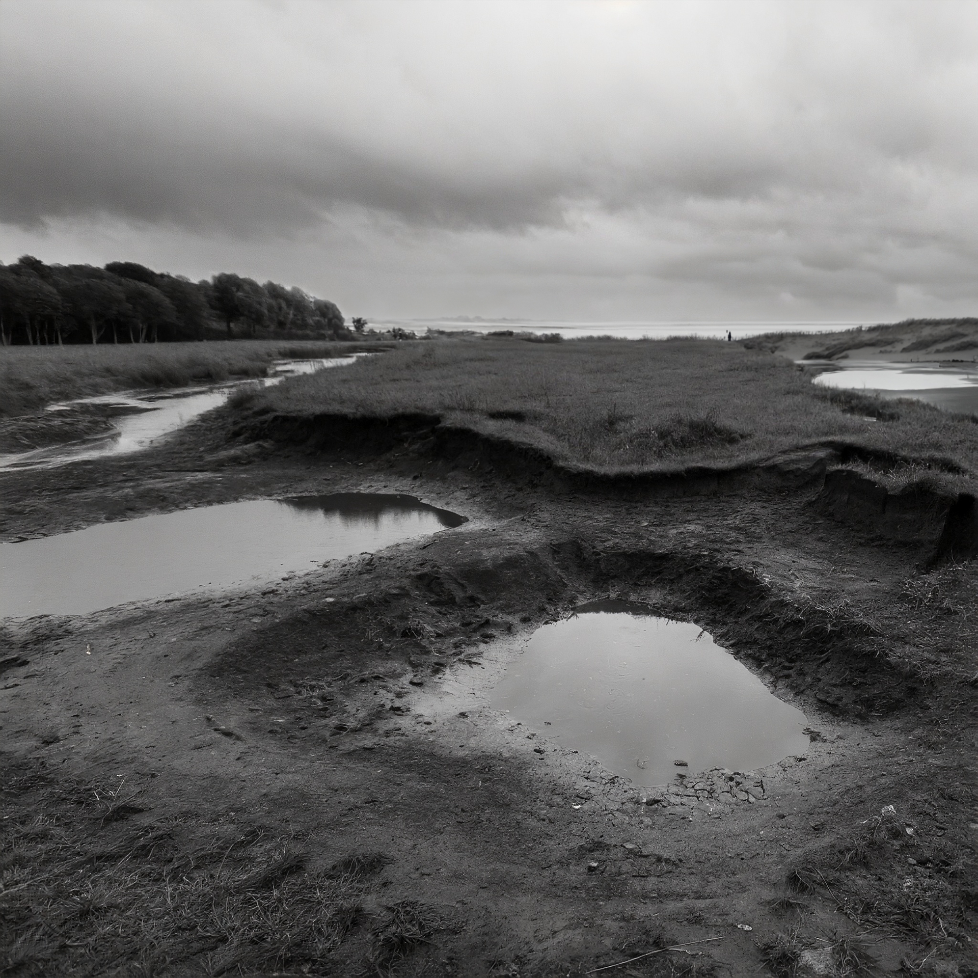
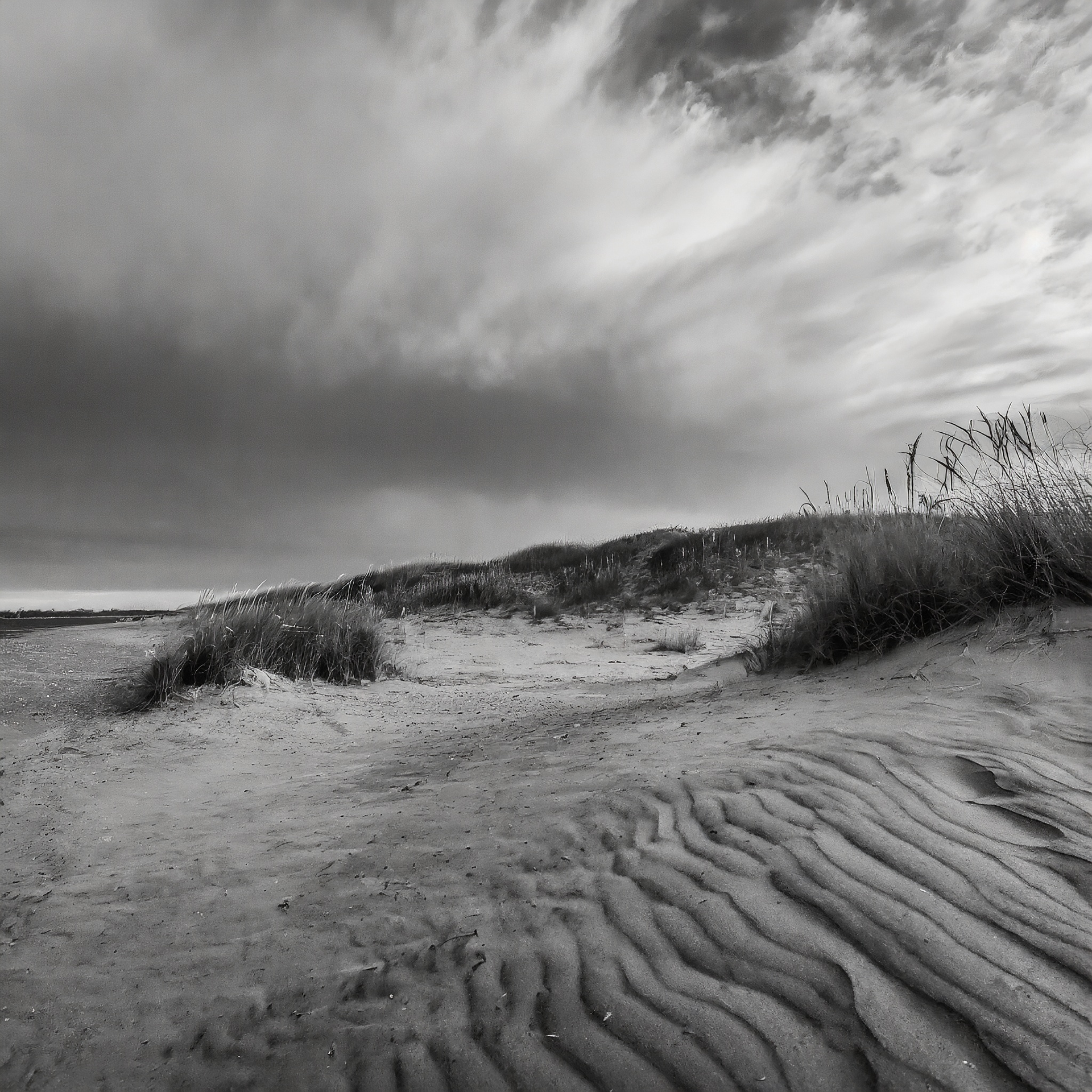
Stage 2 – Erosion & Landform Shaping Natural erosion takes over, gradually reshaping the scored land into smaller fragmented islands that echo the Toronto archipelago. Human infrastructure begins to decay. Boardwalks and paths lose their form, subtly limiting access and emphasizing the site’s shift from human-centered design to ecological priority.

Stage 3 – Decomposition & Disconnection The underwater tunnel that once connected the island to the mainland is deliberately flooded. The tower pavilion remains as a place for passive observation, while other built elements continue to deteriorate. This stage marks a deeper phase of detachment from urban use and infrastructure, allowing decomposition to shape both memory and material.

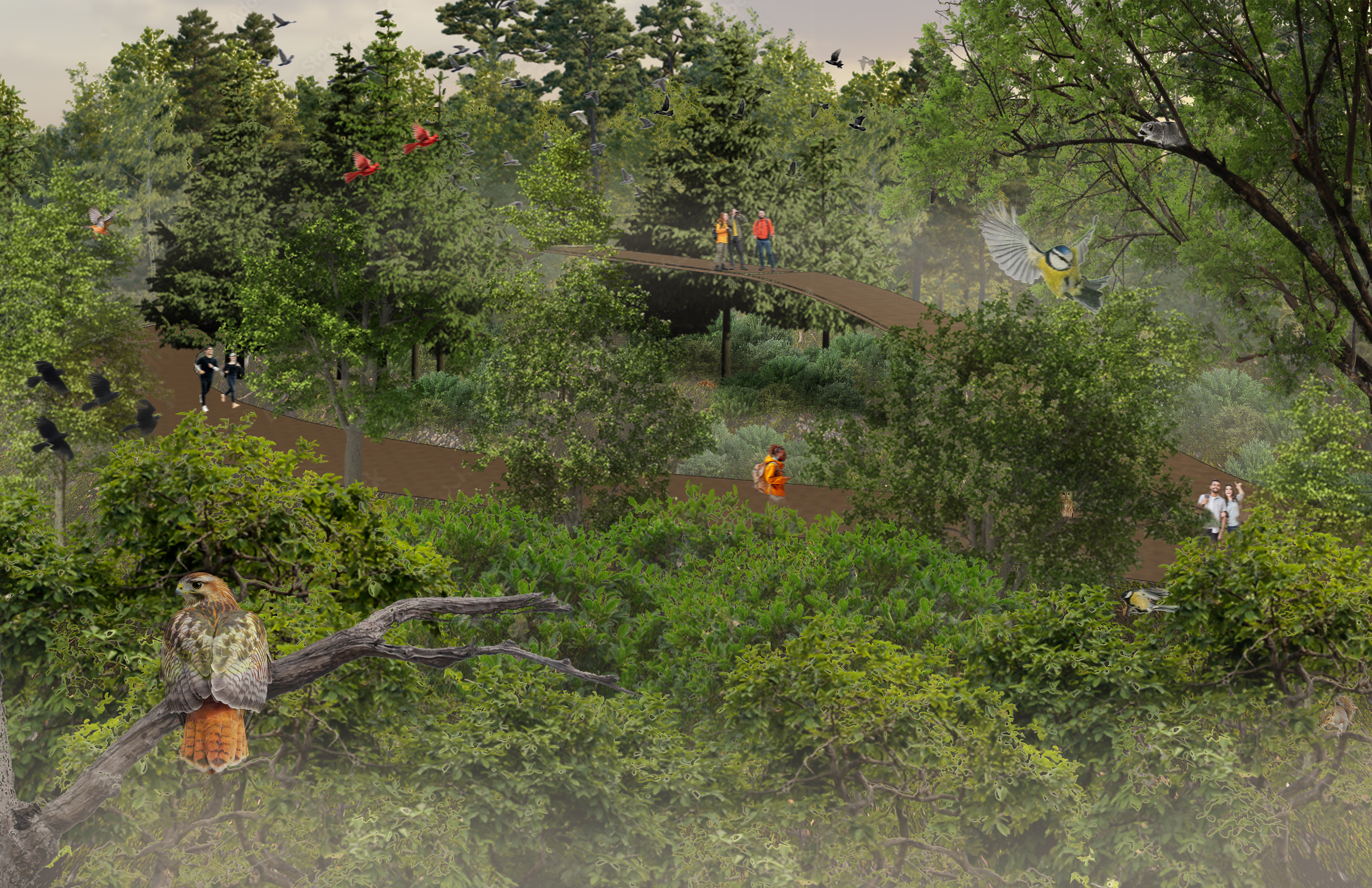
Stage 4 – Succession & Integration Ecological succession reaches its peak. The land, now fully fragmented and eroded, blends into Lake Ontario. Native vegetation dominates, wildlife returns, and the remaining structural remnants are overtaken by nature. The site is no longer recognized as an airport but as a restored, ecologically vibrant landscape within Toronto’s evolving greenbelt.

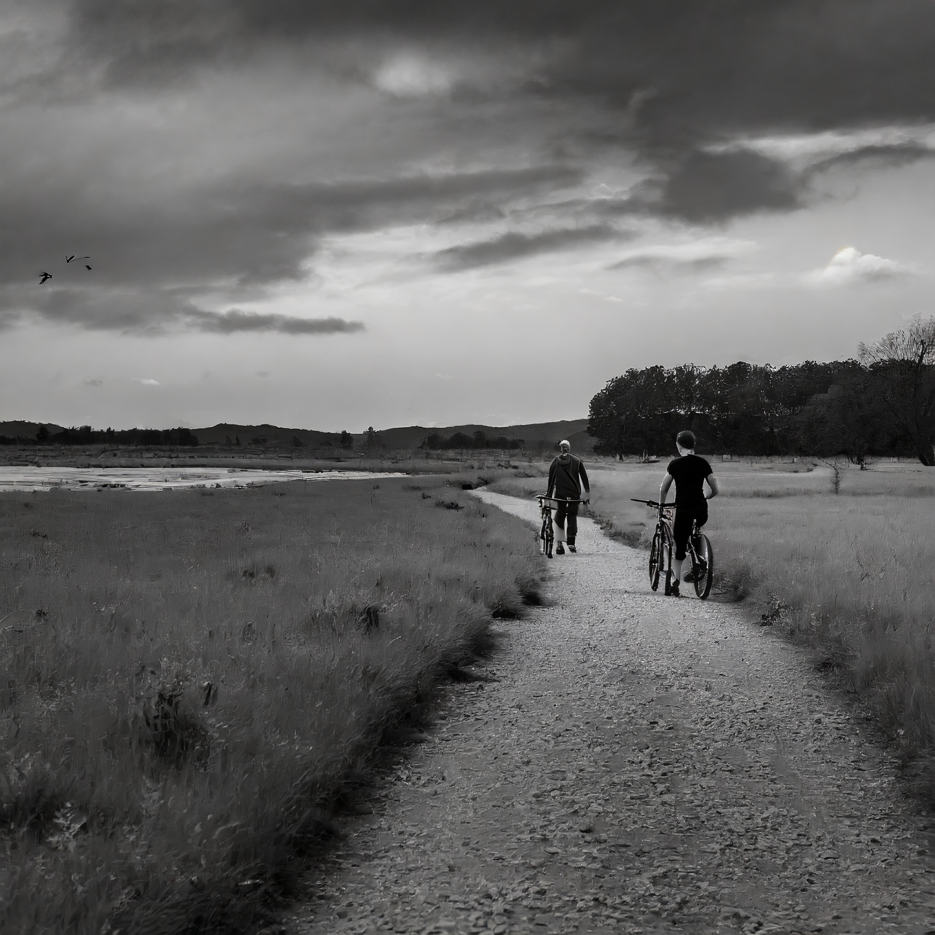
Stage 5 – Ecological Maturity & Mindful Access Over time, wildlife has fully adapted to the regenerated ecosystems, and multiple generations of flora and fauna now call it home. The park exists primarily for its non-human residents, with people welcomed only as quiet observers; mindful guests in a space led by nature.

Light Shaft Moment At the tunnel’s deepest point, a hollowed stone shaft, once an elevator core, now channels daylight deep underground. Standing beneath it becomes a moment of stillness and awe, reminding visitors of their scale within the land, and of the life above.

The Passage Once a direct link between city and airport, the tunnel now serves as a transitional space; guiding visitors underground before they emerge into the rewilded park. Stripped to its concrete shell, it reconnects people to the earth beneath their feet, grounding them in place and purpose.
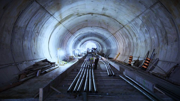
Rebirth Through Descent The tunnel is a quiet, symbolic descent; evoking themes of life, death, and renewal. As visitors pass through the earth before entering the park, the journey becomes a cleansing experience, reminding us that just as we rise from the ground, we will one day return to it.

Water as Sound and Symbol A narrow stream now flows through the center of the tunnel, its sound echoing along the smooth concrete walls. This subtle sensory element enhances the visitor’s awareness, transforming the tunnel into a space of reflection, rhythm, and purity.

The Final Disconnect Over time, the tunnel is left to erode and flood, severing the physical connection between city and park. In its afterlife, the submerged passage may become a refuge for aquatic species or a quiet, preserved relic; offering divers a new way to explore the layered history of the site.

Tunnel Light & Sund Section
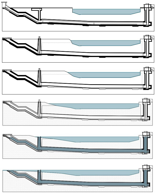
Tunnel Flood Sections
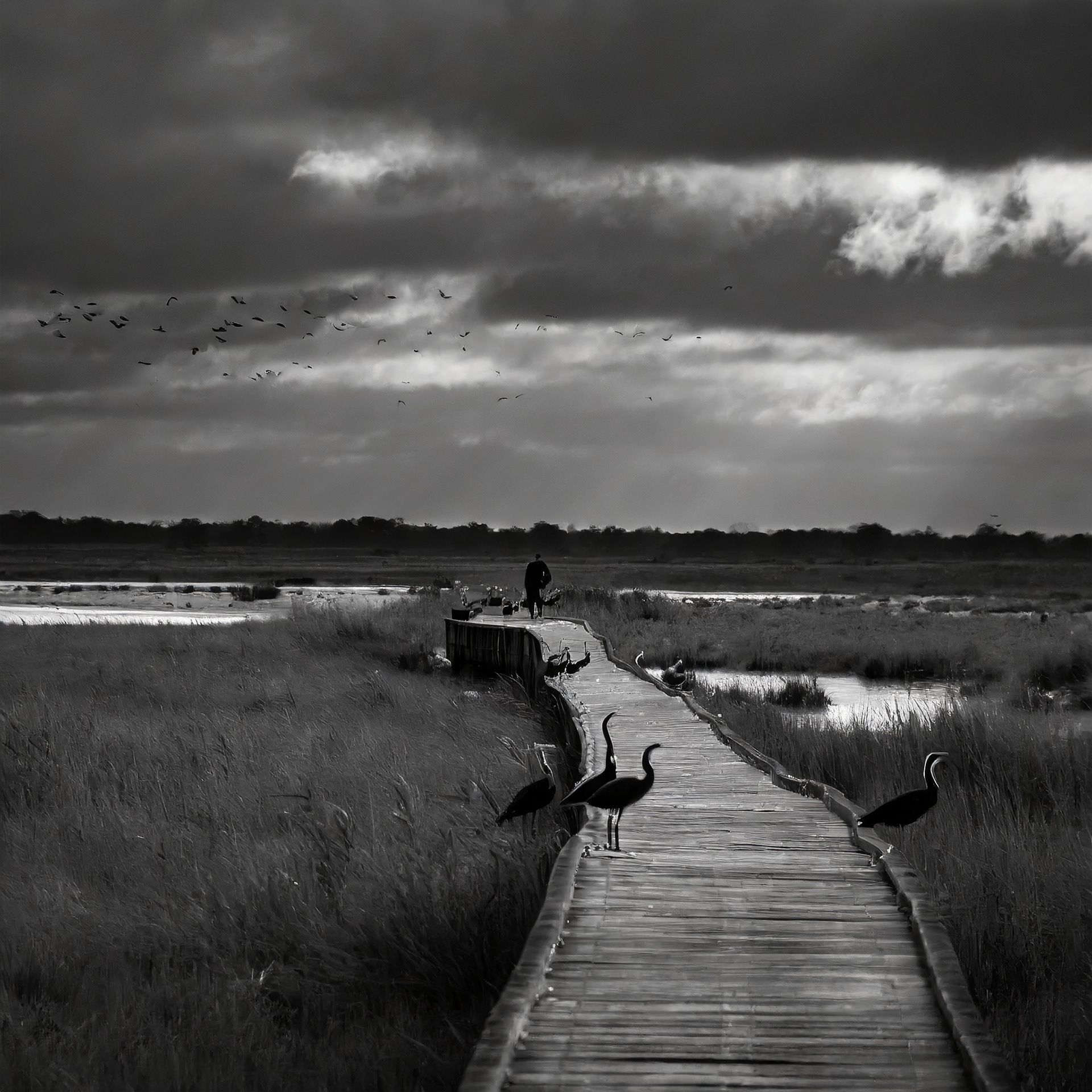
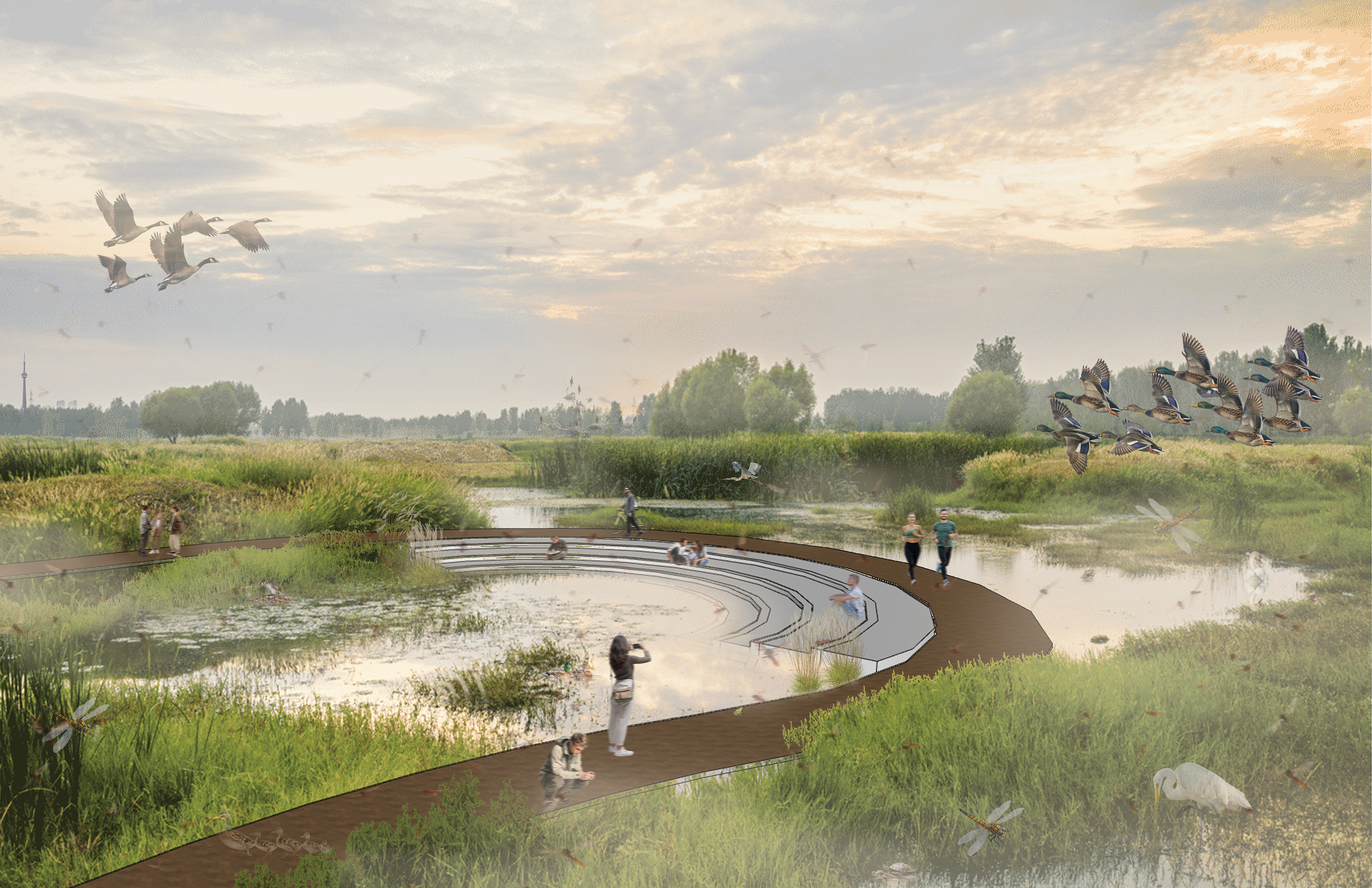
Along the boardwalk of Terminal Succession, eight notable sites create moments of connection between people and the transforming landscape; spaces designed not only for observation and reflection, but also to actively support ecological succession.
The Wetland Amphitheatre (1), where seating is nestled into a rewilded marsh, offering a space to listen to the rhythmic chorus of frogs and observe wetland life in its natural harmony.
The Bird Sanctuary (2) features minimal structures that provide perching and nesting support, inviting guests to witness the thriving interactions of native bird populations in a protected habitat.
The Meadow Walk (3) integrates a path made of recycled grating, allowing grasses and wildflowers to grow freely through its surface. This zone also includes pollinator-friendly installations that nurture bee and insect populations.
The Spawn Pools (4) sit quietly in the lagoon; shielded shallow areas where fish can safely hatch and mature before migrating into Lake Ontario, protected from predators.
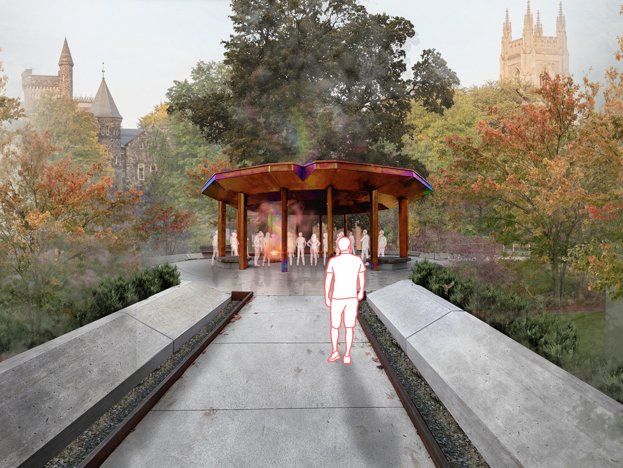
The Observation Tower (5), repurposed from the decommissioned Air Traffic Control Tower, with open-air access and educational plaques that interpret the surrounding ecosystems and their role in the site’s regeneration.
The Flooded Tunnel Outlet (6); once a link between island and mainland is now submerged, surrounded by a rocky archipelago that supports waterfowl while offering a powerful space to reflect on the site's urban past.
The Treetop Trek (7), an elevated section of the path, lifts visitors into the forest canopy, offering a unique vantage point into the vertical life of the emerging woodland and a rare opportunity to walk among the trees.
The Skyline Lookout (8), a quiet, seating-lined edge of the boardwalk that frames a distant view of the Toronto skyline. Here, the contrast between city and sanctuary becomes clear—a reminder of what once was, and what has now taken root.
The Wetland Amphitheatre (1), where seating is nestled into a rewilded marsh, offering a space to listen to the rhythmic chorus of frogs and observe wetland life in its natural harmony.

The Bird Sanctuary (2) features minimal structures that provide perching and nesting support, inviting guests to witness the thriving interactions of native bird populations in a protected habitat.

The Meadow Walk (3) integrates a path made of recycled grating, allowing grasses and wildflowers to grow freely through its surface. This zone also includes pollinator-friendly installations that nurture bee and insect populations.

The Spawn Pools (4) sit quietly in the lagoon; shielded shallow areas where fish can safely hatch and mature before migrating into Lake Ontario, protected from predators.
The Observation Tower (5), repurposed from the decommissioned Air Traffic Control Tower, with open-air access and educational plaques that interpret the surrounding ecosystems and their role in the site’s regeneration.

The Flooded Tunnel Outlet (6); once a link between island and mainland is now submerged, surrounded by a rocky archipelago that supports waterfowl while offering a powerful space to reflect on the site's urban past.
The Treetop Trek (7), an elevated section of the path, lifts visitors into the forest canopy, offering a unique vantage point into the vertical life of the emerging woodland and a rare opportunity to walk among the trees.

The Skyline Lookout (8), a quiet, seating-lined edge of the boardwalk that frames a distant view of the Toronto skyline. Here, the contrast between city and sanctuary becomes clear—a reminder of what once was, and what has now taken root.
The study "Edge Influence on Forest Structure and Composition in Fragmented Landscapes" offers insights into the dynamics of anthropogenically created forest edges and their impact on ecosystem structure and composition. This analysis aims to explore the relevance of this study to an architectural thesis project focused on ecosystem restoration using renaturation techniques. By examining the patterns and processes identified in the study, this analysis seeks to inform the development of strategies for restoring fragmented landscapes and mitigating edge influence.
The study synthesizes existing knowledge on the patterns of forest structure and composition at created forest edges, highlighting the significance of edge influence in fragmented landscapes. It identifies abiotic and biotic gradients near forest edges as primary drivers of edge influence, leading to both direct and indirect responses in vegetation structure and composition. The magnitude and distance of edge influence are found to be influenced by factors such as climate, edge characteristics, and regional context.
The insights provided by the study are highly relevant to a thesis project focusing on ecosystem restoration through renaturation techniques. Renaturation involves reintroducing natural processes and restoring ecological functionality to degraded landscapes, making it essential to understand the dynamics of edge influence and its implications for ecosystem recovery. By recognizing the importance of edge influence in fragmented landscapes, renaturation efforts can be designed to mitigate the negative effects of edge creation and enhance ecological resilience.
Design interventions informed by this analysis can potentially mitigate the adverse effects of edge creation and bolster ecological resilience. Understanding the interplay between edge gradients and vegetation dynamics enables the establishment of transitional zones conducive to ecological connectivity and biodiversity promotion.
The study's emphasis on connecting patterns of edge influence to underlying ecological processes provides a valuable framework for designing renaturation interventions. Design strategies can be informed by an understanding of how edge gradients influence vegetation dynamics, allowing for the creation of transitional zones that facilitate ecological connectivity and promote biodiversity. Moreover, by considering the local and regional context, design interventions can be tailored to specific landscape conditions, maximizing their effectiveness in restoring ecosystem functionality.
The study highlights the need for further research to test hypotheses and validate predictions related to edge influence in fragmented landscapes. Future studies could explore the efficacy of different renaturation techniques in mitigating edge effects and promoting ecosystem recovery. Standardized methodologies and comprehensive descriptions of study sites are recommended to ensure the comparability and reproducibility of findings across different contexts.
The study on edge influence in fragmented landscapes provides valuable insights that can inform the design and implementation of renaturation projects aimed at restoring degraded ecosystems. By understanding the patterns and processes of edge influence, architects and landscape designers can develop innovative strategies to mitigate the negative effects of fragmentation and promote ecological resilience. Through interdisciplinary collaboration and evidence-based design approaches, re-naturalization efforts can contribute to the sustainable restoration of fragmented landscapes and the conservation of biodiversity.
ADDITIONAL RESEARCH + WORK
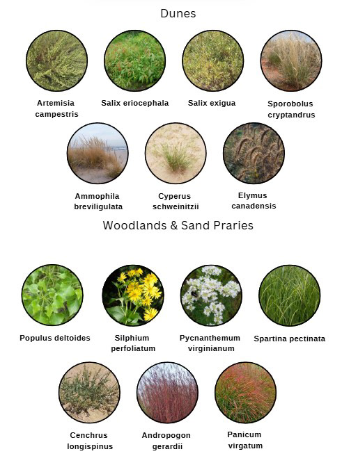
Toronto Islands Environmentally Significant Areas
The Toronto Islands' natural landscapes feature six distinct plant communities: wet meadows, lagoon edges, beach strands, dunes, Cottonwood woodlands, and sand prairies. These communities are regarded as uncommon in our region. Additionally, the Islands boast one of the highest concentrations of rare plant species in the area: 40 regional rarities, 15 species not found elsewhere in our region, and three provincial rarities. In total, 338 plant species have been identified within these natural areas.


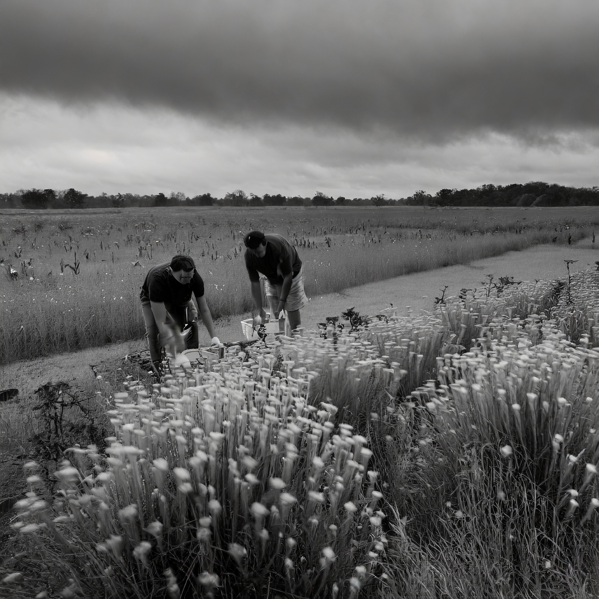
A prescribed burn, also known as a controlled burn or planned fire, is a deliberately ignited fire that is conducted under predetermined conditions to achieve specific ecological or land management objectives. Unlike wildfires, which occur naturally or accidentally and can pose risks to human life and property, prescribed burns are carefully planned and executed to minimize risks while maximizing benefits.
Prescribed burns are typically conducted by trained professionals, such as fire managers or firefighters, who follow a plan that outlines specific parameters for ignition. These parameters include factors such as weather conditions (e.g., wind speed, humidity), fuel moisture levels, terrain characteristics, and safety considerations.
The process of conducting a prescribed burn involves several key stages:
Planning: Fire managers develop a comprehensive plan that outlines the objectives of the burn, identifies the area to be burned, and specifies the conditions under which the burn will be conducted.
Preparation: Before ignition, crews may prepare the burn area by clearing vegetation along designated fire lines or installing firebreaks to control the spread of the fire.
Ignition: Once all preparations are complete and weather conditions are favorable, the prescribed burn is ignited using various techniques such as drip torches, flares, or igniter devices.
Monitoring and Management: During the burn, fire crews closely monitor the fire's behavior and adjust their tactics as needed to ensure the burn stays within predetermined boundaries and achieves its objectives.
Post-burn Assessment: After the fire has been extinguished, fire managers conduct a thorough assessment to evaluate the burn's effectiveness in meeting its objectives. This may involve monitoring changes in vegetation, wildlife habitat, or other ecological indicators.
Prescribed burns offer a range of benefits for biology and ecosystems:
Habitat Restoration: By reducing accumulated vegetation or controlling invasive species, prescribed burns can restore natural habitats and promote the growth of native vegetation. This, in turn, benefits wildlife by providing food, shelter, and breeding habitat.
Biodiversity Enhancement: Prescribed burns create a mosaic of different habitat types, which can increase biodiversity by supporting a variety of plant and animal species with different habitat preferences.
Nutrient Cycling: Burning organic matter releases nutrients back into the soil, enriching soil fertility and promoting the growth of new vegetation.
Fire Adaptation: Many plant species have evolved to depend on periodic fires for seed germination, growth, or reproduction. Prescribed burns help maintain these fire-adapted ecosystems and promote their resilience to future disturbances.
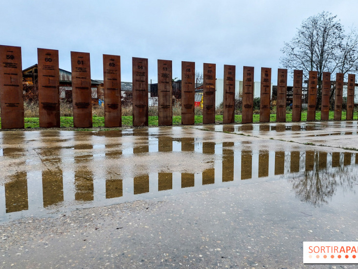
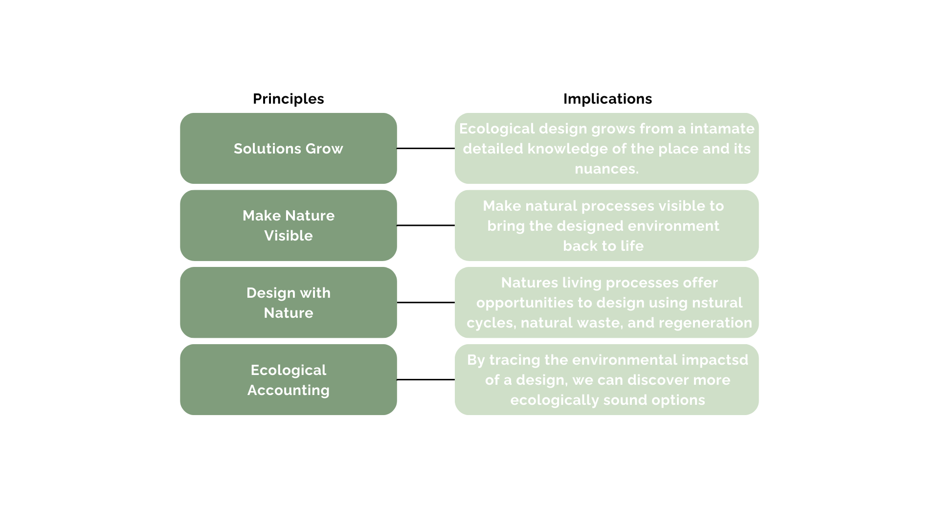
Precedent Analysis: Renaturation of the river Aire, Geneva
The Renaturation of the River Aire, located in Geneva, Switzerland, stands as an exemplary model for the restoration of ecosystems within urban environments. This project, designed by Atelier Descombes Rampini in collaboration with Superpositions, received the prestigious LILA 2018 award in the Public Project Category. By exploring its innovative design approach and successful implementation, this analysis aims to provide insights relevant to a thesis project focusing on ecosystem restoration through renaturation techniques.
The Aire River, historically flowing through agricultural valleys, underwent progressive canalization from the late 19th century. However, in 2001, the State of Geneva initiated a competition to restore the river to its original state by demolishing the canal. Rather than obliterating the existing infrastructure entirely, the winning proposal integrated the canal into a broader renaturation strategy. This decision serves as a crucial precedent, emphasizing the importance of harmonizing ecological imperatives with cultural preservation.


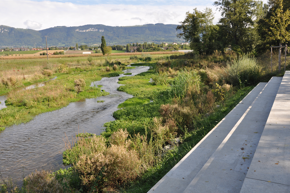

The project transcends its ecological objectives by embedding them within a broader cultural context. By transforming the former canal into a linear series of gardens, the design blurs the boundaries between nature and culture. This linear garden not only enhances the aesthetic appeal of the landscape but also serves as a platform for contemplation and introspection. The footprint of the canal, preserved as a permanent trace, encapsulates the project's temporal complexity, bridging past, present, and future.
A significant aspect of the project's success lies in its implementation strategy. Rather than imposing a rigid design on the river, the architects adopted a flexible approach. They devised a launching pattern for the river, which facilitates its free-flowing design. This diamond-shaped pattern creates a series of undetermined channels, enabling the river to shape its course naturally. The project's ongoing evolution underscores the effectiveness of this approach, as observed through the river's dynamic interactions with its environment.
ICON SCULPTURE
In Toronto, a peculiar trend emerges among its natural parks, where many find themselves occupying spaces once dominated by industry. These parks, born from the ashes of former industrial areas, represent a peculiar narrative of urban adaptation.
Leslie Street Spit, initially intended as a landfill, has metamorphosed into an unexpected haven for nature. Sherbourne Common, once a contaminated industrial site, now boasts green spaces and water features. Similarly, the Port Lands, historically a hub for shipping and industry, are undergoing slow transformation into mixed-use spaces. Toronto's natural parks reflect the ongoing struggle to balance industrial heritage with ecological preservation. They serve as poignant reminders of the city's past and the challenges of harmonizing urbanization with environmental stewardship.

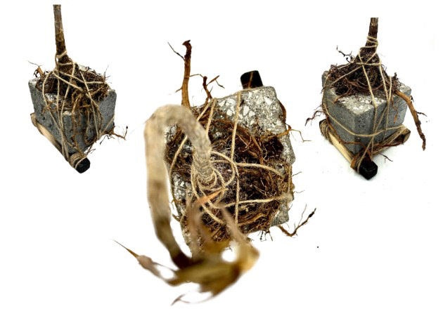
The unique history of Toronto parks is expressed in an emblematic crafted object. It represents not only the city's rich history of industrialization but also its ongoing efforts in renaturalization and conservation. This collection of locally sourced materials stands as a testament to the resilience of nature and the transformative power of human ingenuity, offering visitors a glimpse into the harmonious coexistence of urban life and ecological preservation in Toronto's natural parks.
CONSERVATION
The botanical importance of the Toronto Islands has been acknowledged by the City of Toronto, which has classified the remaining natural spaces as "Environmental Resource Areas," and by the Metropolitan Toronto and Region Conservation Authority, which has designated them as "Environmentally Sensitive Areas." It is imperative that the managers of the Islands, represented by the Metropolitan Toronto government, develop a comprehensive protection strategy for our region's most significant botanical site.
Furthermore, efforts towards restoration should be emphasized alongside protection strategies. Restoration initiatives aimed at preserving and enhancing the natural habitats on the Toronto Islands are crucial for maintaining biodiversity and ecosystem health. This may involve habitat restoration projects, invasive species management, and community engagement programs to foster stewardship and awareness about the importance of conserving these valuable natural areas.
Conservation efforts within urban areas are crucial for preserving wildlife species and enhancing equitable access to nature, yet they face numerous obstacles. This project's approach serves as a model illustrating how urban wildlife corridors can be established through a combination of research, acquiring land, fostering collaboration, restoration and stewardship initiatives, as well as outreach and education campaigns. It demonstrates that these corridors offer a viable strategy for conservation in cities, addressing some of the key challenges encountered. By integrating natural and urban environments, urban wildlife corridors bridge divides between researchers and practitioners, engage various stakeholders, connect neighbouring jurisdictions, amalgamate datasets, and foster interaction between humans and wildlife. Ultimately, employing a collaborative framework centred on urban wildlife corridors can enhance the effectiveness of conservation endeavours, facilitate the redesign of cities to accommodate wildlife, and establish vital connections among stakeholders to drive further action.


Typology 1: Biophilic Urban Park
Program Approach: The typology emphasizes the creation of a biophilic urban park that integrates elements of nature, recreation, and community engagement. It includes features such as walking trails, native plant gardens, wildlife habitats, interactive educational spaces, and cultural gathering areas. The program encourages active participation from local communities, schools, and environmental organizations to foster stewardship and connection to nature.
Site/Context Condition: The optimum site/context for this approach would be a post-industrial landscape like Billy Bishop Airport, where there is ample space for ecological restoration and community activation. The site's proximity to the waterfront offers opportunities to enhance biodiversity, create green corridors, and mitigate environmental pollution in an urban setting.
Typology 2: Eco-Resilient Urban Hub
Program Approach: This typology focuses on creating an eco-resilient urban hub that combines ecological restoration, sustainable infrastructure, and social innovation. The program includes features such as green infrastructure systems (e.g., rain gardens, bioswales), renewable energy installations, eco-friendly buildings, public art installations, and educational facilities. It promotes resilience-building activities and community-driven initiatives that address local environmental challenges.
Site/Context Condition: The ideal site/context for this typology would be an urban brownfield site or degraded waterfront area in Toronto, where there is a need for environmental remediation and revitalization. The site's location within the urban fabric allows for connectivity to existing infrastructure and services, fostering a holistic approach to urban regeneration and sustainable development.